BRIEFING STRIP CONCEPT
Airport Chart Format
The airport chart is normally printed on the back of the first approach
chart. At larger airports the airport chart will preceed the first
approach chart and contain an enlarged diagram. Airport charts
contain information pertaining to the airport including
communications, take-off and alternate minimums, and IFR
departure procedures. Separate airport charts may be included to
display detailed ramp and parking positions or low visibility taxi
routes.
HEADING
Airport, Ramp and Taxiway charts
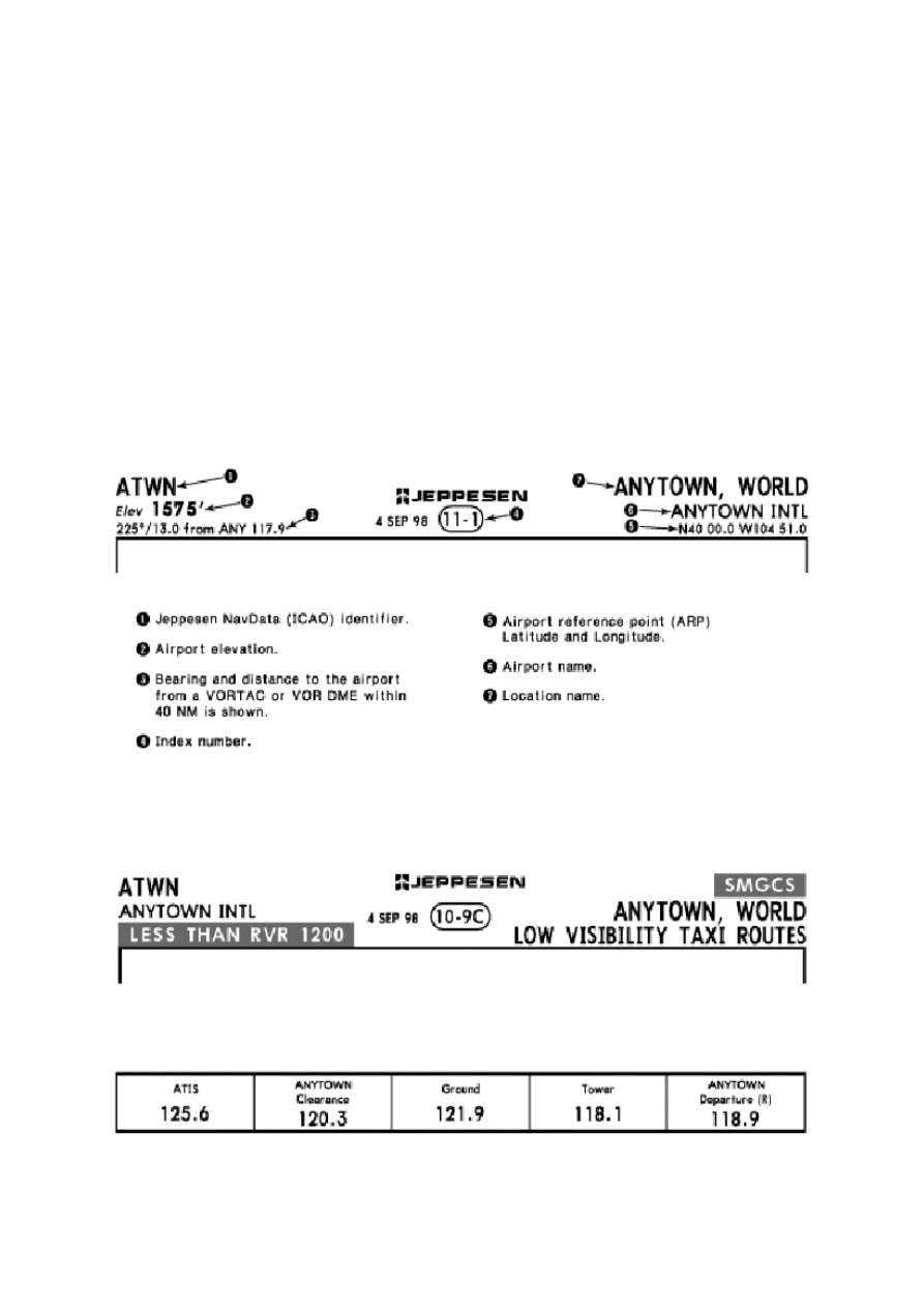
The Airport chart contains the location name, the airport name,
airport elevation, latitude and longitude, Jeppesen NavData (ICAO)
identifier and date.
Low Visibility Taxiway Charts
Low visibility Taxiway Charts and Surface Movement Guidance and
Control System (SMGCS) charts have special labels in the heading
to indicate specific usage.
COMMUNICATIONS
Communications for departure are listed in order of normal use.
AIRPORT DIAGRAM
Airport Diagram Symbols

New symbols used on the airport charts are illustrated below.
Magnetic variation.
Wyszukiwarka
Podobne podstrony:
Printing Airport Chart Format & Heading
Printing Briefing Strip Formats
Printing Briefing Strip Heading
Printing ICAO Recommended Airport Signs
Printing Formats Approach & Airport
Printing Airport Plan view
Printing Airports Enroute
Prezentacja formatka
CHART Tag2
Formaty plików dźwiękowych
Printing bbjorgos lekcja41 uzupelnienie A
Przekroje Format A2
Eisenhower Briefing Document, 18 November 1952
h 1 formatka 2012 budowa hv
Printing bbjorgos lekcja01 05 A
chart
P3 PLAN KONSERWATORSKI (FORMAT 2000x2500)
Formatki do zaj z OC Cwiczenie Nieznany
więcej podobnych podstron